B.C. using 'enhanced technology' to predict wildfire behaviour, officials say
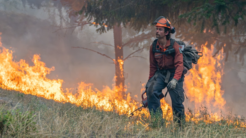
 A firefighter performs small hand ignitions on the 2023 McDougall Creek wildfire near West Kelowna. (Image credit: BC Wildfire Service)
Decision-makers will be using "enhanced technology" to predict wildfire behaviour across B.C. during the 2024 wildfire season, officials announced Monday.
The Ministry of Forests said the predictive software will launch in the Coastal and Kamloops fire centres – where it was tested out last year – before being gradually rolled out in the rest of the province.
"As the impacts of climate change evolve, so too must our ability to manage the threat of wildfires in our communities," Minister Bruce Ralston said in a statement.
"By adding more technology to the BC Wildfire Service's tool kit, our talented firefighters will be able to make critical decisions faster when it matters most."
The government said the technology uses weather models, topographical data and fuel maps along with real-time information from the field to predict wildfire growth and movement.
In a news release, the ministry stressed that the software "does not replace the experience and skills" of BCWS staff, but offers decision-makers "more intelligence and more time to plan their operations."
Officials said the technology was used last August, when a lightning storm resulted in 110 wildfires sparking in the Coastal Fire Centre over four days – and that the software managed to produce predictions for 12-hour spread for each new fire within 15 minutes.
"That allowed us to identify which wildfires were a priority for initial attack resources based on their potential to spread and threaten communities," said Greg Boyachuk, senior wildfire officer for the fire centre, in a statement.
The province is testing additional tools to bolster firefighting efforts, including "drones for aerial ignitions, infrared scanning for hazard assessments, and 5G technology for more sensor networks to monitor forest conditions," the ministry said
CTVNews.ca Top Stories

'The world is too messy for bureaucratic hurdles': Canada still bars Afghanistan aid
Ottawa has plans to finally stop blocking Canadian development aid to Afghanistan this year.
Student anti-war protesters dig in as faculties condemn university leadership over calling police
Students protesting the Israel-Hamas war at at universities across U.S., some of whom have clashed with police in riot gear, dug in Saturday and vowed to keep their demonstrations going, while several school faculties condemned university presidents who have called in law enforcement to remove protesters.
Toxic testing standoff: Family leaves house over air quality
A Sherwood Park family says their new house is uninhabitable. The McNaughton's say they were forced to leave the house after living there for only a week because contaminants inside made it difficult to breathe.
Cisco reveals security breach, warns of state-sponsored spy campaign
State-sponsored actors targeted security devices used by governments around the world, according to technology firm Cisco Systems, which said the network devices are coveted intrusion points by spies.
More than 115 cases of eye damage reported in Ontario after solar eclipse
More than 115 people who viewed the solar eclipse in Ontario earlier this month experienced eye damage after the event, according to eye doctors in the province.
B.C. seeks ban on public drug use, dialing back decriminalization
The B.C. NDP has asked the federal government to recriminalize public drug use, marking a major shift in the province's approach to addressing the deadly overdose crisis.
Decoy bear used to catch man who illegally killed a grizzly, B.C. conservation officers say
A man has been handed a lengthy hunting ban and fined thousands of dollars for illegally killing a grizzly bear, B.C. conservation officers say.
OPP responds to apparent video of officer supporting anti-Trudeau government protestors
The Ontario Provincial Police (OPP) says it's investigating an interaction between a uniformed officer and anti-Trudeau government protestors after a video circulated on social media.
Loud boom in Hamilton caused by propane tank, police say
A loud explosion was heard across Hamilton on Friday after a propane tank was accidentally destroyed and detonated at a local scrap metal yard, police say.


