Wildfires burning in Western Canada create hazy skies across B.C.'s Lower Mainland
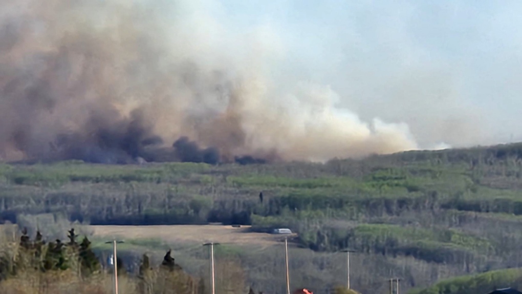
Hazy conditions are expected in the Lower Mainland Wednesday due to smoke from wildfires burning in British Columbia and Alberta.
No advisories are in effect in Metro Vancouver or the Fraser Valley at this time, but officials are monitoring the conditions closely.
The regions rarely see wildfire smoke in May, but experts say it could soon become a regular occurrence.
“It is concerning that we're seeing this quite early,” said Amy Thai, a senior policy analyst for Metro Vancouver’s Air Quality and Climate Change Division.
The region has experienced significant smoke impacts during six of the last eight summers—an alarming trend.
“Climate projections are indicating that we could be in for hotter, longer and drier summers. So that's an indication of what we could see in the future,” said Thai.
“There could be a greater risk for wildfires, which in turn would lead to a greater risk for wildfire smoke,” she added.
The wildfire smoke was thick enough to obstruct the view of the Burnaby skyline on Wednesday morning.
Vancouver landmarks like the Lions Gate Bridge were also hard to make out through the haze. Metro Vancouver says the region is still well below the advisory threshold.
Environment and Climate Change Canada is urging those with underlying health conditions to be cautious.
"People prone to breathing problems, this will certainly not help and you should avoid strenuous activities outside,” said Mike Gismondi, a meteorologist for the weather agency.
The haze that’s drifting into the Lower Mainland is not expected to impact air quality in the region, but there are advisories further north.
Smoke is widespread throughout the central part of the province and is extending into southeastern B.C., along the Rocky Mountains.
“The air quality health index is at 10 plus. Some places are well above 100 micrograms per cubic metre and, just to put that into perspective, the level at which we are concerned from a human health perspective is only 25 micrograms per cubic metre for a 24 hour average. So we're well above that in many communities in the interior,” said Armel Castellan, an emergency preparedness meteorologist for ECCC.
Conditions vary, but are forecast to get worse overnight.
Earlier this week, Metro Vancouver was under a ground-level ozone air quality advisory.
That was triggered by a heatwave that rolled in last weekend, but conditions improved due to cooler temperatures and favourable winds.
A ridge of high pressure is expected to draw more smoke down towards the coast Wednesday. Expect to see a thin layer of haze by the evening and into Thursday.
“As far as air quality, I think at that point, most of the smoke should be elevated. So I think it'll just appear as a thin, sort of haze in the sky rather than really affect the air quality at the surface,” said Gismondi.
The smoke is expected to clear by late Thursday or Friday.
While it’s still unseasonably hot, ECCC says a shift in the weather may come at the end of the long weekend, bringing rain.
The wet weather may help ease fires and smoke, there’s a possibility the conditions could make the flooding situation worse.
With files from CTV News Vancouver’s Kevin Charach
CTVNews.ca Top Stories

'A beautiful soul': Funeral held for baby boy killed in wrong-way crash on Highway 401
A funeral was held on Wednesday for a three-month-old boy who died after being involved in a wrong-way crash on Highway 401 in Whitby last week.
'Sophisticated' cyberattacks detected on B.C. government networks, premier says
There has been a "sophisticated" cybersecurity breach detected on B.C. government networks, Premier David Eby confirmed Wednesday evening.
Police handcuff man trying to enter Drake's Toronto mansion
Toronto police say a man was taken into custody outside Drake's Bridle Path mansion Wednesday afternoon after he tried to gain access to the residence.
Biden says he will stop sending bombs and artillery shells to Israel if they launch major invasion of Rafah
U.S. President Joe Biden said for the first time Wednesday he would halt shipments of American weapons to Israel, which he acknowledged have been used to kill civilians in Gaza, if Prime Minister Benjamin Netanyahu orders a major invasion of the city of Rafah.
Canucks claw out 5-4 comeback win over Oilers in Game 1
Dakota Joshua had a goal and two assists and the Vancouver Canucks scored three third-period goals to claw out a 5-4 comeback victory over the Edmonton Oilers in Game 1 of their second-round playoff series Wednesday.
Nijjar murder suspect says he had Canadian study permit in immigration firm's video
One of the Indian nationals accused of murdering British Columbia Sikh activist Hardeep Singh Nijjar says in a social media video that he received a Canadian study permit with the help of an Indian immigration consultancy.
Pfizer agrees to settle more than 10K lawsuits over Zantac cancer risk: Bloomberg News
Pfizer has agreed to settle more than 10,000 lawsuits about cancer risks related to the now discontinued heartburn drug Zantac, Bloomberg News reported on Wednesday, citing people familiar with the deal.
Quebec premier defends new museum on Quebecois nation after Indigenous criticism
Quebec Premier Francois Legault is defending his comments about a new history museum after he was accused by a prominent First Nations group of trying to erase their history.
U.S. presidential candidate RFK Jr. had a brain worm, has recovered, campaign says
Independent U.S. presidential candidate Robert F. Kennedy Jr. had a parasite in his brain more than a decade ago, but has fully recovered, his campaign said, after the New York Times reported about the ailment.


