'Truly cold air mass' shatters dozens more B.C. weather records
There were dozens more cold weather records broken across British Columbia on Thursday, according to preliminary data from Environment and Climate Change Canada.
Daily minimum temperature records were set from the southern tip of Vancouver Island to the northeastern corner of the province, and many spots in between.
The coldest record-breaking temperature was measured in Fort Nelson, which saw the mercury dip to -43.6 C, beating the previous Dec. 22 minimum of -39.5 from 1984.
The oldest record to fall was in Pitt Meadows, where the temperature dropped to -12.4 C. The previous daily record of -12.2 C was set back in 1879 – 143 years ago.
The weather reached a minimum of -13.5 C in the Vancouver area on Thursday, breaking the previous daily minimum record of -11.5 C.
The full list of daily minimum temperature records set across the province on Thursday include, in alphabetical order:
- Abbotsford – new record of -13.4, previous record of 11.7 set in 1970
- Agassiz – new record of -13.6, previous record of -13.5 set in 1990
- Blue River – new record of -39.8, previous record of -35.8 set in 1983
- Burns Lake – new record of -35.7, previous record of -34.9 set in 1983
- Cache Creek – new record of -30, previous record of -26.5 set in 1983
- Clearwater – new record of -34.5, previous record of -27.8 set in 1924
- Clinton – new record of -35.8, previous record of -27 set in 1983
- Cranbrook – new record of -34, previous record of -30.4 set in 1990
- Dawson Creek – new record of -41.8, previous record of -38.9 set in 1933
- Fort Nelson – new record of -43.6, previous record of -39.5 set in 1984
- Hope – new record of -17.2, previous record of -13.4 set in 1983
- Kamloops – new record of -30.2, previous record of -25.6 set in 1891
- Kelowna – new record of -29, previous record of -25.2 set in 1983
- Lillooet – new record of -26.7, previous record of -22.2 set in 1924
- Lytton – new record of -24.8, previous record of -20.6 set in 1983
- Mackenzie – new record of -38.8, previous record of -29.6 set in 1983
- Malahat – new record of -12.7, previous record of -8.5 set in 1990
- Nakusp – new record of -20, previous record of -19.5 set in 1983
- Nelson – new record of -20.3, previous record of -17.2 set in 1921
- Osoyoos – new record of -21.8, previous record of -17.5 set in 1983
- Penticton – new record of -22.3, previous record of -15.8 set in 1983
- Pitt Meadows – new record of -12.4, previous record of -12.2 set in 1879
- Port Alberni – new record of -13.6, previous record of -13.5 set in 1983
- Prince George – new record of -39.9, previous record of -38.9 set in 1924
- Princeton – new record of -38.6, previous record of -35.3 set in 1983
- Puntzi Mountain – new record of -41.3, previous record of -32.4 set in 2008
- Quesnel – new record of -38.6, previous record of -31.1 set in 1921
- Revelstoke – new record of -26.6, previous record of -23.3 set in 1909
- Salmon Arm – new record of -30.2, previous record of -26.5 set in 1983
- Sechelt – new record of -11.2, previous record of -8.0 set in 1983
- Squamish – new record of -11.7, previous record of -11 set in 1990
- Summerland – new record of -23, previous record of -18.5 set in 1983
- Tatlayoko Lake – new record of -30.9, previous record of -27.8 set in 1964
- Trail – new record of -25.7, previous record of -24.0 set in 1983
- Vancouver – new record of -13.5, previous record of -11.5 set in 1983
- Victoria – new record of -8.4, previous record of -8.3 set in 1998
- Victoria Harbour – new record of -9.5, previous record of -7.8 set in 1983
- Whistler – new record of -21.4, previous record of -20.0 set in 1951
- White Rock – new record of -11.7, previous record of -9.6 set in 1998
- Williams Lake – new record of -36, previous record of -33.3 set in 1983
- Yoho National Park – new record of -39.6, previous record of -36 set in 1990
Environment Canada's weather records page noted the data "may contain preliminary or unofficial information."
Meteorologist Trevor Smith told CTV News the frigid temperatures were the result of a "truly cold air mass" over the province – the same one that has kept roads covered in snow and ice this week, and resulted in repeated warnings to avoid unnecessary travel.
Conditions are expected to get worse heading into the Christmas weekend, with forecasters expecting a mix of snowfall, freezing rain and ice pellets.
"We have a real mess of conditions coming," Smith said. "To make the transition from such a cold air mass into the milder Pacific air, we kind of have to go through this transition, and that's exactly what we're seeing."
Environment Canada is expecting temperatures to begin warming up for most of the South Coast by Sunday, and to remain more typically mild through the New Year's Eve weekend.
With files from CTV News Vancouver's Alissa Thibault


CTVNews.ca Top Stories

Joly, Blair condemn anti-NATO protest in Montreal that saw fires, smashed windows
Federal cabinet ministers condemned an anti-NATO protest in Montreal that turned violent on Friday, saying 'hatred and antisemitism' were on display.
Canada Post down eight million parcels amid strike as talk carry on over weekend
Canada Post says it has seen a shortage of more than eight million parcels amid the ongoing strike that has effectively shut down the postal system for nine days compared with the same period of 2023.
NEW
NEW Thinking about taking an 'adult gap year'? Here's what experts say you should know
Canadian employees are developing an appetite for an 'adult gap year': a meaningful break later in life to refocus, refresh and indulge in something outside their daily routine, according to experts.
Walking pneumonia is surging in Canada. Is it peaking now?
CTVNews.ca spoke with various medical experts to find out the latest situation with the typically mild walking pneumonia in their area and whether parents should be worried.
Prime Minister Trudeau attends Taylor Swift's Eras Tour in Toronto with family
Prime Minister Justin Trudeau is a Swiftie. His office confirmed to CTV News Toronto that he and members of his family are attending the penultimate show of Taylor Swift's 'The Eras Tour' in Toronto on Friday evening.
Minister calls GST holiday, $250 cheques for 18 million Canadians 'a targeted approach'
Women and Gender Equality and Youth Minister Marci Ien is calling the federal government's proposed GST holiday and $250 rebate cheques a 'targeted approach' to address affordability concerns.
Afraid of losing the U.S.-Canada trade pact, Mexico alters its laws and removes Chinese parts
Mexico has been taking a bashing lately for allegedly serving as a conduit for Chinese parts and products into North America, and officials here are afraid a re-elected Donald Trump or politically struggling Prime Minister Justin Trudeau could try to leave their country out of the U.S.-Mexico-Canada free trade agreement.
ICC warrants are binding, EU cannot pick and choose, EU's Borrell says
European Union governments cannot pick and choose whether to execute arrest warrants issued by the International Criminal Court against two Israeli leaders and a Hamas commander, the EU's foreign policy chief said on Saturday.
Doctor at the heart of Turkiye's newborn baby deaths case says he was a 'trusted' physician
The Turkish doctor at the center of an alleged fraud scheme that led to the deaths of 10 babies told an Istanbul court Saturday that he was a 'trusted' physician.
Shopping Trends
The Shopping Trends team is independent of the journalists at CTV News. We may earn a commission when you use our links to shop. Read about us.


Vancouver Island
-
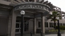
Victoria police face being understaffed amid proposed budget cuts
Layoffs could be imminent for the Victoria Police Department if it adheres to the requests of the City of Victoria, and cuts over $2 million from its budget.
-
Campbell River high school closure extended due to fire
Carihi Secondary school in Campbell River is closed due to a fire on the property overnight – drawing a firefighting response from multiple departments and a crowd of onlookers.
-
Grey Cup streaker fined $10K, banned from BC Place
The woman who ran across the field wearing nothing but her shoes at last weekend’s Grey Cup has been given a fine and banned from BC Place.
Kelowna
-

Man in hospital following targeted shooting in Kamloops
Police are appealing for information on a targeted shooting that resulted in the hospitalization of a man in Kamloops.
-
Police cleared of fault in fatal 2023 crash in B.C.'s Interior
British Columbia's independent police watchdog has cleared officers of wrongdoing in a crash where three people were killed south of Kamloops in July of last year.
-
B.C. woman sentenced for stealing $14K in funds raised for schoolkids
A B.C. woman who stole more than $14,000 in volunteer-raised funds that were supposed to be spent on school supplies and programs – including hot meals for vulnerable kids – won't spend any time in jail.
Edmonton
-

From Instagram to IRL: Where to find this year's trendy treats in Edmonton
From globally-inspired pastries to vegan fast food and Connor McDavid-themed culinary delights, Edmonton has a lot to offer anyone looking to try something trendy.
-
Man armed with knife arrested in west Edmonton: EPS
A man armed with a knife was arrested in west Edmonton Friday afternoon, police said.
-
Afraid of losing the U.S.-Canada trade pact, Mexico alters its laws and removes Chinese parts
Mexico has been taking a bashing lately for allegedly serving as a conduit for Chinese parts and products into North America, and officials here are afraid a re-elected Donald Trump or politically struggling Prime Minister Justin Trudeau could try to leave their country out of the U.S.-Mexico-Canada free trade agreement.
Calgary
-

Snowfall warning for Calgary and southern Alberta expected to continue throughout Saturday
A snowfall warning for Calgary remained in effect early Saturday morning and looks poised to be hanging around all weekend.
-
Calgary activates transit detours amid snowfall warning
The City of Calgary's transit snow detours will be activated on Friday night, with the city expected to receive dozens of centimetres of snow.
-
‘Pinch me I’m dreaming:’ Calgary drummer pulled from crowd to play with the Arkells
For young musicians, to be up on stage in front of thousands of people, would be a dream come true. That’s exactly what happened to a Calgary girl, after being invited to play with Canadian rock icons The Arkells.
Lethbridge
-

Lethbridge’s Ron Sakamoto honoured at Country Music Awards in Nashville
Lethbridge’s Ron Sakamoto is bringing home the hardware from this year’s Country Music Awards.
-
Snowfall warning issued for Lethbridge as organizations, businesses prepare for winter weather
Environment and Climate Change Canada (ECCC) has issued a snowfall warning for Lethbridge and parts of southern Alberta, with about 20 to 30 centimetres of snow expected to fall by Sunday.
-
Hurricanes kick off U.S. road trip with a loss, falling 4-0 to Silvertips
The Hurricanes launched a three-game road trip south of the border Wednesday dropping a 4-0 game to the league-best Everett Silvertips.
Winnipeg
-

Perimeter Highway reopens after semi-truck leaves overpass, collides with train
The 56-year-old semi driver was airlifted to hospital by STARS and is in stable condition with serious injuries.
-
The Thriftmas Special: The benefits of second-hand holiday shopping
The holidays may be a time for family, joy and togetherness, but they can also be hard on the wallet.
-
Manitoba reports first case of mpox, province says risk to public is low
The Manitoba government is reporting the first confirmed case of mpox in the province, noting it is also a strain that has not been seen in Canada before.
Regina
-

Ministry of Highways releases annual snow campaign as Sask. braces for more snow
Snowplows will be on standby ready to go as the province is expected to get more snow over the weekend.
-
Chiropractor accused of sexually assaulting 7 women denies all allegations as part of second day of testimony
Ruben Manz, a Regina-based chiropractor accused of sexually assaulting seven women from 2010 through 2021, denied ever touching any of the alleged victims in a sexual nature while under oath.
-
Here's a look inside the Globe Theatre before it reopens
The format is the same, but the venue looks very different from the last time audiences were inside Regina's Globe Theatre after extensive renovations.
Saskatoon
-

'I'm excited to take it on': Saskatoon businesses weigh in on GST exemption
Some local businesses say the federal government’s recent plan to pull back GST on several items is a positive initiative, but it should have been rolled out earlier in the holiday season.
-
Why isn't Saskatoon's new downtown shelter open yet?
Saskatoon's new downtown shelter must undergo renovations before it can open, according to the operator of the site.
-
Sask. principal has sexual assault conviction overturned in light of 'butt-grabbing game'
A Saskatchewan principal sentenced to six months behind bars for sexual assault has another chance to prove he’s the victim of a middle-school prank that escalated out of control.
Toronto
-

'Her shoe got sucked into the escalator': Toronto family warns of potential risk of wearing Crocs
A Toronto family is speaking out after their 10-year-old daughter's Crocs got stuck in an escalator, ripping the entire toe area of the clog off.
-
'Still working full time on it:' One year later police continue to search for gunman in Caledon double murder linked to ex-Olympian
One year after a couple was shot and killed in their Caledon home in what investigators have described as a case of mistaken identity, Ontario Provincial Police say they are still trying to figure out who pulled the trigger.
-
Swifties live-streaming Eras Tour concerts say they're part of a 'community'
Live streams of Taylor Swift’s sold-out Eras Tour concerts in Toronto give devoted fans a window into the spectacle of outfits, surprise songs and elaborate stages from one of the biggest cultural events in recent memory.
Montreal
-

Residents in Verdun evacuated after suspected arson
Montreal police (SPVM) said a dépanneur in Verdun was targeted in a suspected arson attack early Saturday morning.
-
Two people stabbed in Ahuntsic-Cartierville apartment
Montreal police (SPVM) have confirmed that a 34-year-old man and a 28-year-old woman were stabbed Friday night in an apartment in the Ahuntsic-Cartierville borough.
-
PWHL: Montreal Victoire bounces back to dominate the Ottawa Charge 6-3
The Montreal Victoire ended its preparatory mini-tournament as host team on a positive note with a 6-3 win over the Ottawa Charge on Friday afternoon at the Espace Denis-Savard rink in the Verdun Auditorium.
Ottawa
-

290,000 speeding tickets and counting: A look at how many photo radar tickets have been issued in Ottawa in 2024
Photo radar cameras have caught nearly 300,000 speeders on Ottawa roads so far this year, as the City of Ottawa prepares to expand the automated speed enforcement camera program to another 39 locations over the next 14 months.
-
Seniors facing 60% hike for OC Transpo monthly transit pass in 2025 under new proposal
Ottawa seniors will be facing a 60 per cent hike in transit fares in 2025, instead of a 120 per cent increase, under a new plan to halve a proposed hike in fares for riders over the age of 65.
-
Ottawa Food Bank declares an emergency amid record-breaking usage
The Ottawa Food Bank is calling the record-breaking visits to its food programs "a declaration of emergency," with children and youth and newcomers accounting for more than a quarter of visits last year.
Atlantic
-

17-year-old dies following single-vehicle crash in Turtle Creek: N.B. RCMP
A 17-year-old boy from Petitcodiac, N.B., has died following a single-vehicle crash in Turtle Creek, N.B.
-
Taylor Swift Fan brings souvenir home to Nova Scotia from the Eras tour
Annie Gallant, a 10-year-old from Nova Scotia, brought home a special gift from her first concert.
-
Walking pneumonia is surging in Canada. Is it peaking now?
CTVNews.ca spoke with various medical experts to find out the latest situation with the typically mild walking pneumonia in their area and whether parents should be worried.
London
-

Nuclear operator helps fund affordable housing project in Goderich
The operators of the Bruce Nuclear Plant near Kincardine just donated $1 million towards Huron County’s largest affordable housing project in years.
-
Wingham area raises $3.6 million for new CT scanner
Wingham will be getting its first ever CT Scanner thanks to a multimillion dollar fundraising campaign that just came to a close.
-
Next week’s weather will put the 'brr' in November
We’re off to a damp start this weekend, “Cloudy conditions to kick off your Saturday with the chance of rainfall first thing in the morning [due to] lake effect showers,” said CTV London Meteorologist Julie Atchison. “Over the next 36 hours we will see the chance for showers lingering.”
Kitchener
-

Advocates push for anti-renoviction bylaws as Waterloo Region reports affordable housing progress
On National Housing Day, housing advocacy group ACORN continued to push for anti-renoviction bylaws.
-
Man charged in Kitchener crash involving Grand River Transit LRT
Charges were laid after a crash between an LRT train and a Dodge vehicle shut down a busy Kitchener street for more than eight hours on Thursday.
-
How University of Waterloo researchers could help charge your devices by moving your body
Imagine being able to charge your devices through your body’s movements.
Northern Ontario
-

Northern Ont. First Nation files claim against Ontario and Newmont mining
Taykwa Tagamou Nation, a Cree First Nation located within Treaty 9, has filed a statement of claim against the Province of Ontario and Newmont, a mining company that owns properties in Timmins.
-
Senior killed in dog attack in northern Ont.
An 81-year-old was killed in a dog attack this week in Bonfield, Ont. Police believe three dogs were involved.
-
Whole Foods carrots pulled in expanded recall for E. coli: CFIA
The Canadian Food Inspection Agency has announced an expanded recall on carrots over risks of E. coli O121 contamination, according to a notice issued Friday.
N.L.
-

As N.L. firm pivots, scientists say Canada's green hydrogen dreams are far-fetched
A Newfoundland energy company's embrace of data centres is raising doubts about eastern Canadian hopes of harnessing the region's howling winds to supply Germany with power from green hydrogen.
-
Canadian leads group pushing Vatican for zero-tolerance policy on abuse by clergy
An international group led by a Canadian is in Rome this week to push the Catholic Church to adopt a zero-tolerance policy on abuse by clergy.
-
Newfoundland wind-to-hydrogen company eyes data centre as international market lags
A company hoping to build a multi-billion-dollar wind-to-hydrogen project in western Newfoundland is eyeing other options as Canada's plans to supply Europe with green energy have not yet materialized.


