A storm meteorologists are calling "particularly intense" has prompted numerous weather warnings and the partial closure of a major highway.
The Pacific frontal system barreled south Wednesday afternoon, striking the South Coast overnight. The heavy rain, and in some cases snow, is expected to continue through Thursday, easing into the night.
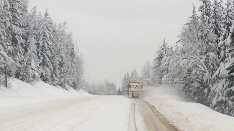
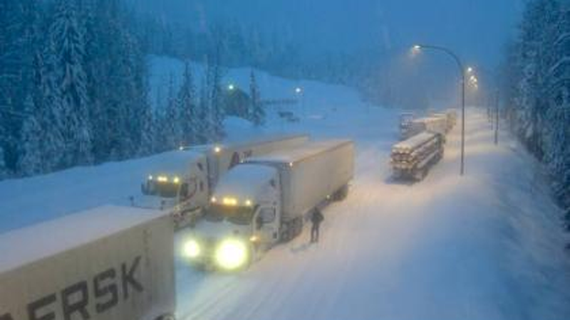
Conditions are expected to be so dangerous along Highway 1 that the stretch between Revelstoke and Golden was closed off for hours. The Ministry of Transportation and Infrastructure said in a statement Thursday morning that the closure was prompted by avalanche risk, and there would be no detour available until the evening.
Avalanche control work was taking place in four areas along the section of highway to ensure drivers' safety when the road is reopened, it said.
- Read more: Avalanche Canada warns of 'extreme' danger on North Shore
"A severe winter storm across much of the southern Interior has brought more than 40 centimetres of snowfall to the region, with 20 or 30 more centimetres expected throughout the day and as much as 50 centimetres forecasted for Rogers Pass," the ministry said.
Highway 1 was also closed in both directions at Kicking Horse Canyon, east of Golden, for avalanche control. It would be reopened when safe, the province said.
Part of Highway 3 was expected to be closed for part of the afternoon for the same reason. The ministry said a section at Kootenay Pass would be blocked off from 1 to 4 p.m., but a detour would be available from Nelson to Creston by Highway 3A and the Kootenay Lake Ferry.
The Coquihalla Highway remained open, but the region fell under a winter storm warning and the portion between Hope and Merritt was expected to see as much as 35 centimetres of snow by Friday morning.
Avalanche control on #BCHwy1 east of #RevelstokeBC near Silver Creek Bluffs @tranbc @DriveBC #BCStorm #beprepared @EmconD #Avalance #snowsafety pic.twitter.com/i5iU3gix5G
— Rocky Mtn District (@TranBCRockyMtn) January 3, 2019
Metro Vancouver rainfall warning
While the storm dumped snow on parts of the province, precipitation fell as rain elsewhere.
Metro Vancouver was drenched with 20 to 30 millimetres of rain Thursday morning, and another 15 to 25 millimetres were expected to fall by evening. Areas near the North Shore mountains could see as much as 40 millimetres, Environment Canada said.
The weather agency warned of a risk of flash flooding and water pooling on roads through the region.
"This is definitely the heart of storm season, which runs from November through February, but this system is particularly intense, packing lots of moisture," Environment Canada's Matt MacDonald told CTV News.
He said at times the rainfall rate reached as much as five millimetres an hour.
Even by Vancouver standards, the rainfall seemed unyielding.
Dog walker Andrea Lewis summed up the storm Thursday morning: "It's just relentless. It's heavy and relentless and the grey makes it all the worse."
Metro Vancouver remains under a rainfall warning first issued Wednesday. The warning also applies to the Fraser Valley, Fraser Canyon, Howe Sound and most of Vancouver Island.
When the system first passed over the area, it brought snow to parts of the Lower Mainland.
A dusting fell over Burnaby Mountain Wednesday night before transitioning to rain.
'Hazardous' conditions on Sea to Sky
Up the Sea to Sky Highway, Whistler saw more than 50 centimetres of snow between Wednesday and Thursday mornings, and a tree came down over the highway near Pemberton Thursday morning.
Environment Canada issued a winter storm warning for Whistler, saying warm air is likely to change the heavy snow to rain or wet snow.
The weather warning, which was rescinded Thursday afternoon, warned that "hazardous winter conditions are expected… Travel is not recommended."
By 3 p.m., traffic cameras showed the majority of the highway had been cleared of snow, though some sections looked slushy.
The forecast calls for wet snow or rain the rest of the day, with a high hovering around the freezing mark.
With a report from CTV Vancouver's Sheila Scott and Breanna Karstens-Smith
To receive Environment Canada weather warnings and alerts straight to your phone, download CTV Vancouver's free Weather Watch app. Check out this page for more information, including how to download.
Morning view of #bcstorm from Lynn Valley: RAIN. @CTVMorningLive pic.twitter.com/C48jvHYu2W
— Sheila Scott (@Sheila_Scott) January 3, 2019

