First snowfall of the season expected in B.C. this week, Environment Canada says
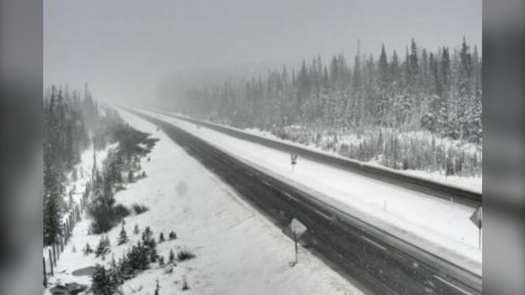
 Snow seen on the Okanagan Connector about 74 kilometres west of Kelowna on May 22, 2020. (Drive BC)
Drivers are being warned that some mountain passes in southeastern British Columbia are expected to get the first snowfall of the season this week.
Environment Canada has issued a special weather statement, saying a slow-moving arctic front is expected in the Columbia and Kootenay region.
It says about five to 10 centimetres of snow could accumulate on the Trans-Canada Highway, including Eagle Pass and Rogers Pass, and is warning drivers to be alert and adjust driving based on road conditions.
The weather office says Revelstoke, Golden, and Tsar Creek can expect showers mixed with flurries on Monday that will transition to periods of snow that night.
It says Rogers Pass and Yoho Park - Kootenay Park are expected to see periods of snow starting Monday morning that will continue through Tuesday.
In East Kootenay and Elk Valley, it says snow will begin Monday night and persist until late Tuesday afternoon.
This report by The Canadian Press was first published Oct. 22, 2023.
CTVNews.ca Top Stories

'Mayday! Mayday! Mayday!': Details emerge in Boeing 737 incident at Montreal airport
New details suggest that there were communication issues between the pilots of a charter flight and the control tower at Montreal's Mirabel airport when a Boeing 737 made an emergency landing on Wednesday.
Trudeau appears unwilling to expand proposed rebate, despite pressure to include seniors
Prime Minister Justin Trudeau does not appear willing to budge on his plan to send a $250 rebate to 'hardworking Canadians,' despite pressure from the opposition to give the money to seniors and people who are not able to work.
Hit man offered $100,000 to kill Montreal crime reporter covering his trial
Political leaders and press freedom groups on Friday were left shell-shocked after Montreal news outlet La Presse revealed that a hit man had offered $100,000 to have one of its crime reporters assassinated.
Cucumbers sold in Ontario, other provinces recalled over possible salmonella contamination
A U.S. company is recalling cucumbers sold in Ontario and other Canadian provinces due to possible salmonella contamination.
Trudeau says no question incoming U.S. president Trump is serious on tariff threat
Prime Minister Justin Trudeau says incoming U.S. president Donald Trump's threats on tariffs should be taken seriously.
In a shock offensive, insurgents breach Syria's largest city for the first time since 2016
Insurgents breached Syria's largest city Friday and clashed with government forces for the first time since 2016, according to a war monitor and fighters, in a surprise attack that sent residents fleeing and added fresh uncertainty to a region reeling from multiple wars.
Canada Bread owner sues Maple Leaf over alleged bread price-fixing
Canada Bread owner Grupo Bimbo is suing Maple Leaf Foods for more than $2 billion, saying it lied about the company's involvement in an alleged bread price-fixing conspiracy.
John Herdman resigns as head coach of Toronto FC
John Herdman, embroiled in the drone-spying scandal that has dogged Canada Soccer, has resigned as coach of Toronto FC.
Musk joins Trump and family for Thanksgiving at Mar-a-Lago
Elon Musk had a seat at the family table for Thanksgiving dinner at Mar-a-Lago, joining President-elect Donald Trump, Melania Trump and their 18-year-old son.


