More snow on the way for B.C.'s South Coast, Environment Canada warns
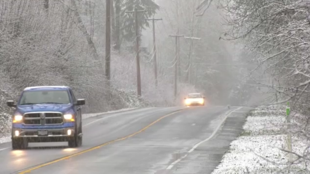
 Parts of the Fraser Valley saw several centimetres of snow on Saturday, and Environment and Climate Change Canada says more is on the way Sunday night. (CTV)
Parts of the Fraser Valley saw several centimetres of snow on Saturday, and Environment and Climate Change Canada says more is on the way Sunday night.
The weather agency has issued a special weather statement for most of Vancouver Island, the Sunshine Coast, the Lower Mainland and Howe Sound.
It says snow accumulations between two and 10 centimetres are possible by Monday morning, potentially affecting morning commutes.
"Snow from the system will start over Vancouver Island Sunday evening and spread to the mainland overnight," the statement reads.
"The snow is expected to taper off Monday morning. As snow levels hover near the surface over some localities, the snow could be wet or mixed with rain."
The heaviest snow is expected over higher elevations and in inland sections of Vancouver Island, Environment Canada says.
"For the Lower Mainland, Sunshine Coast and Howe Sound, amounts of two to five centimetres are likely," the agency says. "However, there is still uncertainty associated with the strength and track of this weather system, and some forecast models show the potential for even higher snowfall amounts into Monday morning. These forecast snowfall accumulations may change as we get closer to the event."
CTVNews.ca Top Stories

MPs approve $21.6B in supplementary spending; Conservatives vote against
MPs have voted to approve an additional $21.6 billion in government spending. The money, which is supplementary to this year's federal budget, will fund various programs including First Nations child services, dental care and compensation to Quebec for services to asylum seekers.
'Which one of those two is going to win?': Poilievre prods Trudeau, Freeland over spending tension
Revived talk of tensions between Prime Minister Justin Trudeau and Deputy Prime Minister and Finance Minister Chrystia Freeland prompted new questions Tuesday, about how big the federal deficit will be in next week's economic update.
DEVELOPING Luigi Mangione shouts as he is led into courthouse where he contests extradition to N.Y.
The suspect in the killing of UnitedHealthcare’s CEO struggled with deputies and shouted Tuesday while arriving for a court appearance in Pennsylvania, a day after he was arrested at a McDonald’s and charged with murder.
Waterloo Region mistakenly applied $13.7M discount to Amazon build in Blair
The Region of Waterloo will not be able to demand $13.7 million from a developer after they said a discount was mistakenly issued for the development of an Amazon fulfillment centre.
Ex-minister cites 'threat to security' for denying emergency passport to Abdelrazik
Former foreign minister Lawrence Cannon says he denied an emergency passport to Abousfian Abdelrazik in 2009 because he considered the Montreal man a possible threat to national security.
Dolly Parton explains why her longtime husband doesn't attend events with her
Dolly Parton has been married for 58 years, but you probably could count on one hand the times you have seen her with her husband.
TikTok files legal challenge of federal government's shutdown order
TikTok is challenging the federal government’s order to shut down its operations in Canada, claiming it will eliminate hundreds of jobs and potentially terminate a quarter of a million contracts that it has with Canadian advertising clients.
Flair Airlines CFO Sumanth Rao charged with involuntary manslaughter after fatal crash in U.S.
Flair Airlines' chief financial officer Sumanth Rao is facing involuntary manslaughter charges in connection with a fatal crash involving an underage driver who had been drinking at his Atlanta-area home.
‘Immediately stop using’: Health Canada warns against use of baby car seat bought on Amazon.ca
Health Canada released a consumer product advisory against the use of a baby car seat availible for purchase on Amazon.


