Metro Vancouver hit with massive flooding, road closures on the day of B.C. provincial election
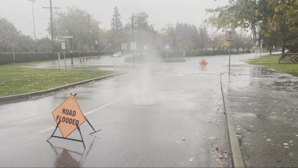
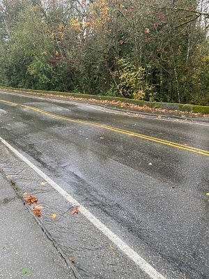
A powerful atmospheric river caused street flooding in parts of Metro Vancouver Saturday, closing some roads and soaking voters headed to the polls in B.C.'s provincial election.
North Shore Emergency Management has opened a reception centre for residents of North Vancouver and West Vancouver displaced by the storm.
There are no evacuation orders or alerts in place, but videos posted online show floodwaters encroaching on homes and businesses in multiple locations on the North Shore.
The reception centre is located at Mickey McDougall Recreation Centre, 240 E. 23rd St. in North Vancouver.
NSEM called its region "the epicentre" of the storm, saying in a statement that the volume of rain was "overwhelming" storm drainage systems in the municipalities it covers.
"There is overland flooding across the North Shore," the statement reads, advising residents to avoid unnecessary travel and "stay away from trails near streams, creeks and rivers and steep slopes."
Gallant Avenue in Deep Cove became a torrent of rushing water, with video from the scene showing some businesses attempting to erect barriers to divert the water away from their doors.
'Straight into our house'
West Vancouver police shared video of muddy water and debris flowing down the steep hill of 21st Street near Queens Avenue.
Ross Dick-Cleland's house was in the path of the flood.
"About 8:15 this morning, the stream burst up on 21st," Dick-Cleland told CTV News.
"So the water all came raging down 21st and and Queens – that we're on – and came straight into our house."
He said more than a dozen friends and neighbours pitched in to help divert the flow of the water away from the home.
"We're used to the rain here and we're used to some water, but I've never seen – there were two-foot boulders getting swept down the street," he said.
Now, Dick-Cleland is beginning the cleanup process.
"Our retaining wall's gone, but no one's hurt and the building'll be fine, so altogether OK," he said.
Both the east and westbound on-ramps to Highway 1 from 21st Avenue were closed due to flooding, police said.
Farther down the hill in Ambleside Park, video shared with CTV News shows water shooting out from a manhole cover.
 In West Vancouver, video shared with CTV News shows water shooting out from a manhole cover at Ambleside Park. (CTV News)
Elsewhere on the North Shore, video posted on social media shows McKay Creek transformed into churning rapids.
"If you are experiencing flooding in your home, and it is significant, please shut off the power if it is safe to do so and call 911," North Shore Emergency Management said.
"Emergency responders are prioritizing calls and response."
East Vancouver, Burnaby and Surrey
In East Vancouver, the intersection of Nanaimo and McGill streets was partially underwater.
Mounties in Surrey closed the intersection of 76 Avenue and 152 Street due to significant flooding.
"Several vehicles attempted to drive through the water, but became disabled," Surrey RCMP said in a statement Saturday morning.
"Water at the location is approximately waist high. The intersection is currently blocked off."
- In Pictures: Election day flooding in Metro Vancouver
Police also advised the public to stay away from the intersection of King George Boulevard and 128 Street, where pooling water in the southbound lanes from the Pattullo Bridge reduced traffic to a single lane.
It was a similar scene in the Still Creek area of Burnaby, where CTV News cameras located several submerged vehicles.
One car appeared to be floating, and the water was up to the windows of a parked minivan.
Low-lying areas of the city are seeing “significant” flooding, Burnaby staffers said in an information bulletin in the afternoon.
The City of Burnaby said crews are putting sandbags down at sanitary sewer stations along Still Creek.
The city asked residents to stay away from rivers and streams, and to clear any leaves or debris from curb gutters and catch basins on their street.
“Conditions may be unsafe in affected areas due to water pooling on roads and swollen creeks and rivers. People travelling around the city should expect impacts to traffic and transit, and roads may be closed temporarily until conditions improve,” the notice reads.
Langley sinkhole
In Langley, local Mounties advised that they had been called to "a possible sinkhole developing on 40th Avenue" between 216 and 212 streets.
"Heavy rainfall within the past 24 hours has compromised the stability of the roadway on 40th Avenue between 216 Street and 212 Street," said Cpl. Zynal Sharoom of the Langley RCMP, in a news release.
"Motorists, cyclists and pedestrians are being advised to avoid the area and find alternate routes."
 Langley RCMP shared this photo of a "possible sinkhole developing on 40th Avenue" Saturday. The road has been closed to traffic. (Langley RCMP)
DriveBC reported several vehicle incidents and road closures due to flooding, and advised motorists to proceed with caution due to pooling water.
"Posted speed limits are for ideal conditions," the agency said on social media.
Rainfall and flood warnings
BC Hydro reported as many as 7,700 customers without power in the Lower Mainland and on the Sunshine Coast during the day Saturday.
Outages affected polling stations in Langley and on the Gulf Islands, according to Elections BC, which said it had to switch to manual voting until power was restored.
Rainfall warnings have been in effect for most of Vancouver Island, the Lower Mainland and the south and central coasts since Friday.
Environment and Climate Change Canada said the first atmospheric river of the season is expected to bring up to 120 millimetres of rain to west and inland Vancouver Island on Saturday and into Sunday, with 150 millimetres expected near Vancouver Island's coast and more than 250 millimetres forecast over mountainous terrain.
Metro Vancouver and the Sea-to-Sky corridor may get up to 150 millimetres of rain, with precipitation amounts exceeding 180 millimetres expected over the North Shore Mountains, according to the weather agency.
The atmospheric river will also roll over B.C.'s southern Interior, with prolonged periods of heavy rain expected to persist through Sunday.
The rain has also prompted flood watches and warnings from the B.C. River Forecast Centre.
On Friday, the centre issued flood watches for several rivers along the central and south coasts, Lower Fraser tributaries, waterways in Metro Vancouver and on Vancouver Island.
It upgraded those watches to warnings on Saturday for the Coquitlam River and parts of the west coast of Vancouver Island near Tofino, Bamfield and Port Renfrew.
The City of Port Coquitlam joined the North Shore in opening a reception centre Saturday.
- Read more: Flood warnings in effect due to B.C. storm
According to the river forecast centre, a flood watch means "river levels are rising and will approach or may exceed bankfull," and flooding may occur.
Flood warnings mean "river levels have exceeded bankfull or will exceed bankfull imminently," and flooding of adjacent areas is inevitable.
With files from The Canadian Press
Shopping Trends
The Shopping Trends team is independent of the journalists at CTV News. We may earn a commission when you use our links to shop. Read about us.


CTVNews.ca Top Stories

opinion
opinion Tom Mulcair: Prime Minister Justin Trudeau's train wreck of a final act
In his latest column for CTVNews.ca, former NDP leader and political analyst Tom Mulcair puts a spotlight on the 'spectacular failure' of Prime Minister Justin Trudeau's final act on the political stage.
B.C. mayor gets calls from across Canada about 'crazy' plan to recruit doctors
A British Columbia community's "out-of-the-box" plan to ease its family doctor shortage by hiring physicians as city employees is sparking interest from across Canada, says Colwood Mayor Doug Kobayashi.
'There’s no support': Domestic abuse survivor shares difficulties leaving her relationship
An Edmonton woman who tried to flee an abusive relationship ended up back where she started in part due to a lack of shelter space.
Baseball Hall of Famer Rickey Henderson dead at 65, reports say
Rickey Henderson, a Baseball Hall of Famer and Major League Baseball’s all-time stolen bases leader, is dead at 65, according to multiple reports.
Arizona third-grader saves choking friend
An Arizona third-grader is being recognized by his local fire department after saving a friend from choking.
Germans mourn the 5 killed and 200 injured in the apparent attack on a Christmas market
Germans on Saturday mourned the victims of an apparent attack in which authorities say a doctor drove into a busy outdoor Christmas market, killing five people, injuring 200 others and shaking the public’s sense of security at what would otherwise be a time of joy.
Blake Lively accuses 'It Ends With Us' director Justin Baldoni of harassment and smear campaign
Blake Lively has accused her 'It Ends With Us' director and co-star Justin Baldoni of sexual harassment on the set of the movie and a subsequent effort to “destroy' her reputation in a legal complaint.
Oysters distributed in B.C., Alberta, Ontario recalled for norovirus contamination
The Canadian Food Inspection Agency has issued a recall due to possible norovirus contamination of certain oysters distributed in British Columbia, Alberta and Ontario.
New rules clarify when travellers are compensated for flight disruptions
The federal government is proposing new rules surrounding airlines' obligations to travellers whose flights are disrupted, even when delays or cancellations are caused by an "exceptional circumstance" outside of carriers' control.
Vancouver Island
-

B.C. mayor gets calls from across Canada about 'crazy' plan to recruit doctors
A British Columbia community's "out-of-the-box" plan to ease its family doctor shortage by hiring physicians as city employees is sparking interest from across Canada, says Colwood Mayor Doug Kobayashi.
-
B.C. woman with photographic memory strives to make unforgettable Christmas displays
Although Alisha Pauling is looking through old pictures, she doesn’t need them to remember her Christmases past. She has a photographic memory.
-
Internet stranger's kind gesture restores Canucks fan's faith in humanity
A Nanaimo, B.C., couple is in awe at the kindness of an internet stranger who helped them track down a coveted Christmas gift.
Kelowna
-

Forfeited Hells Angels clubhouse in Kelowna, B.C., sold to the city
A former Hells Angels clubhouse that was seized by the British Columbia government in 2023 after years of fighting in court has been sold to the City of Kelowna.
-
Death of woman found in Kelowna's Waterfront Park in June deemed 'non-criminal in nature': RCMP
Police in Kelowna say a death they began investigating back in June has now been confirmed as "non-criminal in nature."
-
B.C. man sentenced for 'execution-style' murder of bystander in drug trade conflict
A B.C. man convicted of the "intentional and ruthless killing of a bystander" while acting as an enforcer in the drug trade has been sentenced for a second time in the slaying.
Edmonton
-

'There’s no support': Domestic abuse survivor shares difficulties leaving her relationship
An Edmonton woman who tried to flee an abusive relationship ended up back where she started in part due to a lack of shelter space.
-
Icy conditions: Alberta RCMP warn of poor driving conditions on QEII between Leduc and Red Deer
Alberta RCMP issued a warning to drivers Saturday morning about slick conditions on the QEII between Leduc and Red Deer.
-
Heavy police presence in south Fort McMurray: RCMP
RCMP warned Fort McMurray residents Saturday night about an unfolding police incident in Beacon Hill.
Calgary
-

'This shouldn't happen': Calgary family seeks changes after WestJet accessibility incident
A Calgary woman wants WestJet to apologize to her daughter and to improve staff training on accessibility after an incident during their latest trip.
-
Promise of high-level hockey comes at a cost for prep school players at Circle K Classic
Calgary is set to host the Circle K Classic, welcoming some high-end talent and pricey prep schools for the annual U18 AAA hockey tournament.
-
Flames get goals from 6 players in a 6-4 victory over the Blackhawks
Jonathan Huberdeau, Connor Zary, Blake Coleman, and Matt Coronato each had a goal and an assist as the Calgary Flames beat the Chicago Blackhawks 6-4 on Saturday.
Lethbridge
-

Search of suspicious vehicle in south Lethbridge leads to seizure of drugs, cash
A 28-year-old woman has been charged after a search of a suspicious vehicle led to the seizure of drugs and cash.
-
‘A moment of happiness’: Lethbridge 911 dispatchers getting help from dog to alleviate stress
Inside Lethbridge’s Public Safety Communications Centre (PSCC) is a four-legged team member weaving in and out from under the desks, shaking a paw and flopping over to get a belly rub all in an effort to reduce stress and anxiety of emergency dispatchers answering the calls of those in need of help.
-
'Fairly close' and ending 'as anticipated': Lethbridge-West stays with the Alberta NDP in byelection
What was expected to be a tight byelection took nearly three hours to call. Rob Miyashiro won to keep Lethbridge-West for the Alberta NDP.
Winnipeg
-

Residential parking ban lifted in Winnipeg
The City of Winnipeg has lifted its parking ban on residential streets, which means its winter route ban is back in effect.
-
Bail denied for Winnipeg woman accused of killing animals in online videos
Warning: This story contains disturbing details. Discretion is advised. A Winnipeg woman accused of making videos of animals being tortured and killed that were sold on the dark web was denied bail.
-
Ace Burpee's Top 100 Most Fascinating Manitobans of 2024
It’s been another year of Manitobans doing interesting, incredible and cool things. The hardest part of compiling this list is cutting it off at 100.
Regina
-

Gathering held in Regina to recognize Winter Solstice
Regina's mâmawêyatitân centre held a day of gathering for the Winter Solstice on Saturday.
-
Canada's first sustainable Tim Hortons location to open in Regina this weekend
Canada’s first sustainable Tim Hortons opens in Regina this weekend. The restaurant, located in the city’s east end, features design and operating features that minimize environmental impact.
-
Gravelbourg's transportation program celebrates addition of new vehicle and garage
The town of Gravelbourg is celebrating the addition of a new vehicle and garage which will be used in their local transportation program.
Saskatoon
-

Sask. police investigating mischief incident after bomb report in school
Prince Albert police are investigating a mischief incident after a bomb report in a school Friday afternoon.
-
Prince Albert woman collects donations to make Christmas hampers for community
A Prince Albert woman is spreading holiday cheer by organizing Christmas hampers for those in need.
-
Sask. lawyers defend judge for staying fatal THC-impaired driving charge
The Saskatchewan Trial Lawyers Association is defending a provincial court judge, who’s facing backlash for staying a charge in a high-profile case involving the death of a child.
Toronto
-

Man arrested for allegedly sexually assaulting a minor in Mississauga
Peel police have arrested a suspect who allegedly sexually assaulted a female minor in Mississauga's Square One area on Dec. 9.
-
Leafs captain Auston Matthews misses game against Islanders with undisclosed injury
Maple Leafs captain Auston Matthews sat out Saturday night’s game against the New York Islanders with an undisclosed injury.
-
Toronto opens 2 more warming centres as temps dip below -15 C
Toronto is opening two additional warming centres at 5 p.m. on Saturday to support people experiencing homelessness as the temperature is expected to dip to a chilly -15 C.
Montreal
-

Major factory fire in the Maskinonge, Que.
A major fire devastated an industrial building in the municipality Maskinongé, Que on Saturday.
-
West Island clinic set to close at the end of December
Statcare Emergency Clinic in Pointe-Claire will shut its doors on Dec. 31.
-
Here's how you can watch CTV News Montreal at Six on Saturday during the NFL season
With CTV broadcasting NFL football games on Saturdays this season, CTV News Montreal at Six will be broadcasting live on our website and the CTV News App.
Ottawa
-

Ottawa Senators fans, organization embracing 'mullet man' mascot
Gatineau-based Ottawa Senators Jay Trepanier has been dubbed the "mullet man" after his flowing haircut caught the attention of the television cameras during a game in October.
-
What's open and closed in Ottawa over the holidays
CTVNewsOttawa.ca takes a look at what's open and closed over the Christmas and New Year's holidays this year.
-
Ottawa MP Mona Fortier appointed chief government whip
Ottawa-Vanier MP Mona Fortier has been appointed as chief government whip, the latest addition in a major reshuffle of Prime Minister Justin Trudeau's cabinet.
Atlantic
-

Cancellations, closures accompany Maritime storm
There are a number of closures in the Maritimes Saturday after a nor'easter brought heavy snow to parts of the region.
-
Calling all bloodhounds: These P.E.I. blood donors have four legs and a tail
Dogs are donating blood and saving the lives of canines at the University of Prince Edward Island's Atlantic Veterinary College in Charlottetown.
-
Youth dies following accident in Moncton, N.B.
RCMP in Moncton, N.B., said one of two passengers, a youth, involved in an accident on Monday, has died in hospital as a result of his injuries.
London
-

New Canadians displaced after fire destroys east London townhome
A family of new Canadians from Nigeria are looking for a new home just before Christmas. Fire destroyed their townhome on Bentley Drive in northeast London, Ont. Friday night.
-
Feeling Festive? Check out this display of over 300 lit Christmas trees
“We have over 300 Christmas trees on display, the majority of them are sponsored and decorated by all of our amazing local businesses,” says Ashley Mason, event and hospitality manager at CASO Station and ECRM in St. Thomas, Ont.
-
Sarnia Police Auxiliary Unit works to return stolen shopping carts to businesses
The high cost of crime is often passed on to consumers – whether it’s shoplifting, vandalism or property damage.
Kitchener
-

'I'm still thinking pinch me': lost puppy reunited with family after five years
After almost five years of searching and never giving up hope, the Tuffin family received the best Christmas gift they could have hoped for: being reunited with their long-lost puppy.
-
Impaired driver causes significant delays on Waterloo highway
A 24-year-old man is facing charges after driving while drunk across two Waterloo Regional highways on Friday.
-
Fire destroys home in Haldimand County
A home in Haldimand County has been destroyed after a Saturday afternoon fire.
Northern Ontario
-

Robinson Superior First Nations provided settlement offer from Canada over annuities owed
Details haven’t been made public yet about the settlement offer presented on Friday by Canada to the 12 First Nations in the Robinson Superior Treaty Territory.
-
Northern Ont. man illegally killed three moose, one deer
A man from the northwestern Ontario community of Dinorwic has been found guilty of multiple hunting offences and fined $6,500, banned from hunting for five years and placed on probation for 18 months.
-
opinion
opinion Tom Mulcair: Prime Minister Justin Trudeau's train wreck of a final act
In his latest column for CTVNews.ca, former NDP leader and political analyst Tom Mulcair puts a spotlight on the 'spectacular failure' of Prime Minister Justin Trudeau's final act on the political stage.
N.L.
-

Newfoundland woman washed sick patients' hair every Saturday for more than 20 years
A retired nurse and teacher in Newfoundland was honoured this week for her volunteer work, which included more than two decades washing the hair of bedridden hospital patients.
-
Newfoundland man facing more charges related to youth sex crimes
A 64-year-old Newfoundland man charged with dozens of sex crimes involving young people is facing several new charges.
-
After fanfare of Churchill Falls deal, Newfoundland urged to learn its dam lessons
Energy observers in Newfoundland and Labrador are urging the provincial government to take a sober second look at a massive tentative deal announced last week with Quebec that promises to deliver hundreds of billions of dollars in revenue to the Atlantic province.


