
Metro Vancouver is known for stunning scenery and great trails, but it can be hard to find that perfect path for the whole family to enjoy.
Author Colleen MacDonald did the legwork for her book of more than 80 maps, titled, "Let's Go Biking." The book features her picks for best bike rides for all levels, as well as top options for pedestrians and runners.
"I'm just thrilled that it gets people out there," the cyclist said Monday morning.
"I realized while there's fabulous maps of greenways and places to go cycling, it wasn't put together in a concise way so that people could actually find the scenic places to visit."
She joined CTV Morning Live Vancouver to share some of her favourites.
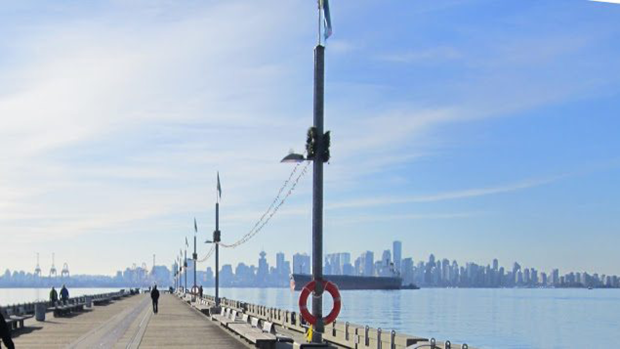
Harbour Loop
"Vancouver – actually, I've always said this for the last 10 years – is one of the best cycling places in the world," she said.
Her first choice is the 32-kilometre Harbour Loop, which starts along Vancouver's shores and goes along the North Shore greenway. The loop goes across the Vancouver and North Vancouver waterfronts, crossing Burrard Inlet over the Lions Gate and Ironworkers bridges. https://www.letsgobiking.net/wp-content/uploads/2016/01/7-HARBOUR-2019-03-12-Printable-1.pdf
"It's absolutely stunning over there. It's one of the best trails in the world, this route," she said.
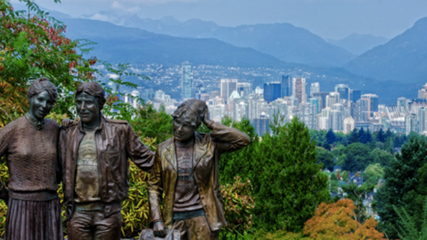
Queen Elizabeth Park Loop
The Queen Elizabeth Park Loop follows the Seaside, Cypress, Arbutus, Ridgeway and Ontario greenways, and rewards cyclists with a sweeping view from the hill in the park.
It's a 20-kilometre loop.
"That's one of the best views in the city to see the mountains and the cityscape, and I just love it up there," she said.
It's a bit of a workout to get to the top of the hill.
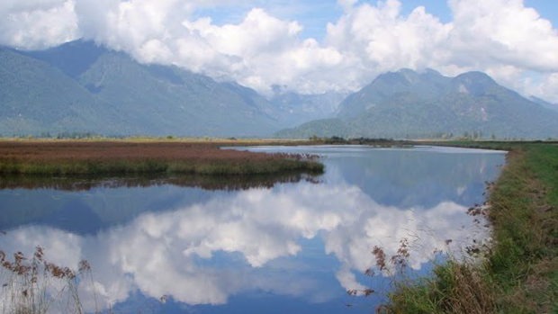
Pitt Lake/Pitt River
The Pitt Meadows "gem" involves a dyke trail and a bumpy road, taking cyclists along the river and up to Pitt Lake. It's a 20-kilometre stretch one way.
Cyclists bike past what MacDonald describes as "Van Gogh scenery" – mountains, water, cranberry fields and more.
"It's beautiful up in that part of the world," she said.
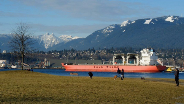
Portside
Cyclists use the Portside Bikeway to follow the Vancouver shoreline, taking in mountain views and passing ships as they go.
The trail takes bikers to New Brighton Park and Hastings Park. The route is 10 kilometres one way.
"When I was a little girl, that was the view from my bedroom window, and I've always found it a fabulous place," MacDonald said.
"We have amazing, amazing places to visit in Vancouver."
She said she's designed the book so it can be folded and carried in a clear plastic bag or map case, and everything is on one page.
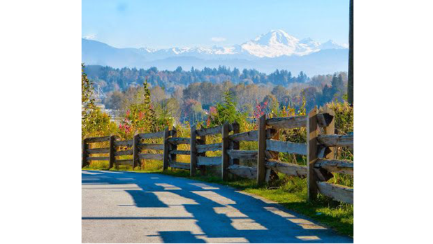
Discovery Trail
This Abbotsford path features views of one of MacDonald's favourite things: Mount Baker. The Discovery Trail West takes riders from Gardner Park to Fish Creek Park, then on to MacLure, Clearbrook and Old Riverside parks.
It's nine kilometres one way.
The Discovery Trail East takes cyclists from Highway 11 and Hazelwood-Abbotsford along an 11-kilometre route one way. They're encouraged to follow the path to Sumas Dyke Trail then turn back.
"There's just so many places to explore and so little time to do it, but this book will help you get to the spots that I love the most," MacDonald said.
The book is available online, as well as in most bookstores and at Waves Coffee.
All proceeds go to HUB Cycling, Trails BC and the B.C. Cycling Coalition.
"These are the people that work for us and make cycling safer and family friendly," she said.
All photos provided by Colleen MacDonald


