Jan. 12 update: Freezing rain, more snow in forecast for Fraser Valley
A heavy dumping of snow is falling in parts of the province, elevating the risk of avalanches along B.C.'s South Coast.
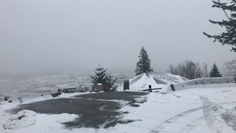
Environment Canada issued several weather advisories Thursday for a swath of the province from central Vancouver Island to the Boundary region, with some areas expected to see as much as 15 centimetres of snow to fall in a short period of time.
Rain that fell over the Fraser Valley in the morning turned to snow as temperatures dropped. Environment Canada warned those passing through the valley should be prepared for quickly changing conditions.
Local police echoed the warning, urging drivers to take it slowly during the evening commute.
"We're also recommending that people have snow tires if you're travelling this weekend," Abbotsford Police Sgt. Judy Bird said.
"It's quite deceptive right now as our western areas are facing some rainfall. However, as soon as you hit the Sumas Way and Whatcom Road intersections, we are experiencing slippery conditions."
A snowfall warning suggested most parts of the valley would see between 10 and 15 centimetres, but Hope and Chilliwack could see as much as 30 centimetres of snow before it tapers to flurries.
More snow is in the forecast for Friday when another weather system arrives, Environment Canada said.
Drivers using the Coquihalla Highway between Hope and Merritt, and Highway 3 between Hope and Princeton, were warned that the snow is expected to continue into the night.
Snowfall warnings have also been issued for Fraser Canyon, Similkameen, Nicola, the Okanagan Valley and the Boundary region, all of which forecast 10 to 15 centimetres.
Areas further west are more likely to see rain than snow, the weather agency said, but the Sea to Sky region falls under a special weather statement due to an Arctic front resting over the South Coast.
Howe Sound will see about five centimetres of snow on Thursday, and there is a risk of freezing rain in Squamish Friday morning.
At the same time, snow is expected over higher elevations between Victoria and Campbell River, as well as inland Vancouver Island and the southern Gulf Islands. Those areas could see five to 10 centimetres, and there is a risk of freezing rain Thursday afternoon and evening.
In addition to Environment Canada's advisories, Avalanche Canada issued a public warning for the South Coast mountains.
The risk of avalanche is considered high at the alpine and treeline levels, and those heading uphill are advised to take a conservative approach. The warning will remain in place until end of day Monday.
Avalanche Canada warned the risk is especially high in the following regions: Lizard Range and Flathead, South Rockies, Purcells, Kootenay Boundary, North and South Columbia, Glacier National Park and the Cariboos.
Existing snowpacks contain weak layers buried under recent snowfall, the warning said.
"The weight of the new snow has brought this unstable snowpack to a critical point, making it very easy for skiers or snowmobilers to trigger large avalanches."
Warmer temperatures forecasted for the weekend will add to the instability, officials said.
There have been a number of close calls reported in the first 11 days of January, Avalanche Canada said.
A man died near Fernie, B.C. on Monday, and a skier had to be rescued in Mount Seymour Provincial Park Tuesday after triggering an avalanche that swept him downhill.
"Many of these incidents are occurring in what is generally considered fairly safe terrain, such as relatively low-angle slopes, treed areas and even heavily tracked slopes," forecasting program supervisor James Floyer said in a statement.

