Risk of thunderstorms on B.C.'s South Coast after heat wave passes
There could be thunderstorms on B.C.'s South Coast after this week's short heat wave dissipates, according to Environment and Climate Change Canada.
Parts of the region are expected to experience an "upper level disturbance" from late Friday morning into the afternoon, the agency said in a special weather statement.
"This disturbance will carry the risk of thunderstorms, capable of producing gusty winds through the inlets and valleys of the inner South Coast," reads a statement issued Thursday afternoon.
Areas that could be affected include Howe Sound, Indian Arm, Pitt Lake, Alouette Lake, Stave Lake, Pemberton and Lillooet Lake.
Meanwhile, heat warnings remain in place for much of the Lower Mainland. The high temperatures that began Wednesday, in what officials described as a "short-lived" heat wave, are expected to ease Friday.
ECCC urged the public to watch for the signs of heat illness, including swelling, rash, cramps, fainting, exhaustion, heat stroke and the worsening of some health conditions.
"The risks are greater for young children, pregnant women, older adults, people with chronic illnesses and people working or exercising outdoors," the agency warned.
Several hot weather records were broken Wednesday, including in Pemberton and Lillooet, which saw temperatures reach 37 C and 38.2 C, respectively.
Other records were broken on Vancouver Island and the Sunshine Coast.


CTVNews.ca Top Stories
Budget 2024 'likely to be the worst' in decades, former BoC governor says
Without having seen it, former Bank of Canada governor David Dodge believes that Tuesday's 2024 federal budget from Deputy Prime Minister and Finance Minister Chrystia Freeland is 'likely to be the worst budget' in decades.
What's at stake for Canada after Iran's unprecedented attack on Israel
Following the Iranian missile and drone strikes against Israel over the weekend, Canada should take the threat of Iran and potential escalation of the conflict seriously, one global affairs analyst says.
Former B.C. school trustee's 'strip-tease artist' remark was defamatory, judge rules
A controversial former school trustee from B.C.'s Fraser Valley who described a political rival as a "strip-tease artist" during an election campaign has been ordered to pay her $45,000 for defamation.
'A sense of urgency': Sask. man accused of abducting daughter calls himself to the stand during trial
Michael Gordon Jackson, the man on trial after being charged with contravention of a custody order for allegedly abducting his daughter in late 2021 to prevent her from getting a COVID-19 vaccine, called himself to the stand Monday.
Kingston, Ont.'s Aaliyah Edwards drafted into WNBA
After four years at the University of Connecticut, Edwards was selected sixth overall by the Washington Mystics in the WNBA draft Monday night.
NASA confirms mystery object that crashed through roof of Florida home came from space station
NASA confirmed Monday that a mystery object that crashed through the roof of a Florida home last month was a chunk of space junk from equipment discarded at the International Space Station.
A knife attack in Australia against a bishop and a priest is being treated as terrorism, police say
Horrified worshippers watched online and in person as a bishop was stabbed at the altar during a church service in Sydney on Sunday evening.
Body of 14-year-old boy pulled from Lake Ontario, police say he drowned while swimming
The body of a 14-year-old boy has been pulled from Lake Ontario after police say he drowned while swimming near Ashbridges Bay Park on Sunday night.
'Rust' armourer gets 18 months in prison for fatal shooting by Alec Baldwin on set
A movie weapons supervisor was sentenced to 18 months in prison in the fatal shooting of a cinematographer by Alec Baldwin on the set of 'Rust.'
Shopping Trends
The Shopping Trends team is independent of the journalists at CTV News. We may earn a commission when you use our links to shop. Read about us.


Vancouver Island
-

B.C. woman facing steep medical bills, uncertain future after Thailand crash
The family of a Victoria, B.C., woman who was seriously injured in an accident in Thailand is pleading for help as medical bills pile up.
-
B.C. fraudster who lured investors with promise to help homeless fined by securities regulator
A Vancouver woman whose company duped investors by promising big returns on real-estate deals that would house the homeless has been ordered to pay nearly $626,000 after the British Columbia Securities Commission deemed the operation a Ponzi scheme.
-
Arctic and offshore patrol vessel HMCS Max Bernays arrives in CFB Esquimalt
The HMCS Max Bernays made its way into its new home at CFB Esquimalt on Monday after a long journey from Halifax.
Kelowna
-

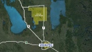
B.C. to add 240 complex-care housing units throughout province
British Columbia is planning to add 240 new units to its complex-care housing program, providing homes for people with mental-health and addictions challenges that overlap with other serious conditions.
-
Evacuation of Kelowna, B.C., apartment near construction site extended for two weeks
More than 80 residents from a low-income apartment building in Kelowna, B.C., have learned they won't be able to return to their homes for at least another two weeks.
-
2 men injured after 'road rage' incident with Dodge Ram driver, Kelowna RCMP say
Mounties are investigating a reported "road rage" incident in Kelowna, B.C., that left two men injured last week.
Edmonton
-

Tickets issued after large, unleashed dog spotted in front of home where boy was killed by dogs
Two tickets were issued after an unleashed dog was seen in front of a home where a boy died in a dog attack earlier this month.
-
Alberta committed to reviewing treatment of trans youth, Smith says in exclusive interview
In an exclusive interview with CTV News Edmonton on Monday, the premier said a study out of the United Kingdom, the Cass Review, echoes some of her concerns in regards to a lack of scientific rigor when it comes to puberty blockers.
-
Alberta announces wage offer for government workers during collective bargaining
The Alberta government is offering a 7.5-per-cent wage increase in the midst of collective bargaining, with government workers calling for a 26-per-cent bump.
Calgary
-

Academics, rural municipalities raise concerns about Alberta's Bill 18
Alberta legislation pitched to protect provincial priorities could slow down grant funding and allow federal money to be spent elsewhere, say officials representing rural municipalities and faculty members at post-secondary institutions.
-
Okotoks, Alta., family faces limited options as two young children battle rare genetic disorder
A young Okotoks, Alta., family is preparing for a long year ahead, as the first of their two children begins a stem cell transplant they hope will prolong her life.
-
Calgary now has a safe surrender site for babies
The cradle is an anonymous drop-off site where an infant can be left in a heated, secured bed, signalling a silent alarm which informs staff.
Lethbridge
-

Phillips calls for funding to be reinstated to Lethbridge Elder Abuse Response Network
Lethbridge West MLA Shannon Phillips is calling on the province to reinstate funding for the Lethbridge Elder Abuse Response Network.
-
Southern Alberta could be alive with the sound of rattlesnakes this weekend: expert
If you’re planning to head to the coulees this weekend to enjoy the nice weather, don’t forget to look down.
-
Lethbridge police team up with campaign to urge drivers to slow down
With the weather starting to feel like spring is really here, more kids will likely be outside enjoying the sunshine and warm temperatures, which organizers of the Slow Your Roll campaign say is a perfect time to re-launch the campaign.
Winnipeg
-
Rural Manitoba council may be dissolved after mass exodus of elected officials: province
A mass exodus of elected officials from a rural Manitoba municipality has put the community in limbo and may force the province to dissolve what's left of the crumbling council.
-
Overland flood warning issued for parts of Manitoba
An approaching low-pressure system that could bring 50 millimetres of mixed precipitation has triggered a flood warning for parts of Manitoba.
-
Lights, camera, action! Extras Casting Underway for Ke Huy Quan movie in Winnipeg
If you’ve ever felt the allure of Hollywood and wanted to be in a big-budget movie your time to shine is now.
Regina
-

Sask. NDP, advocates call for full reopening of Moose Jaw hyperbaric chamber
Moose Jaw's hyperbaric chamber has now partially resumed services after being discontinued in 2021 due pandemic related staffing shortages. However, only one patient is currently being treated leading to criticism over a perceived lack of service.
-
'A sense of urgency': Sask. man accused of abducting daughter calls himself to the stand during trial
Michael Gordon Jackson, the man on trial after being charged with contravention of a custody order for allegedly abducting his daughter in late 2021 to prevent her from getting a COVID-19 vaccine, called himself to the stand Monday.
-
Regina's Jon Ryan to retire a Seahawk
Regina's Jon Ryan is set to sign a one-day contract with the Seattle Seahawks tomorrow officially bringing to an end his pro-football career.
Saskatoon
-

Saskatoon Muslim community mourns teen killed in high-speed crash
Friends are raising money for the grieving family of a 16-year-old Saskatoon boy who was killed in a high-speed crash that injured two other teens on Sunday morning.
-
Sask. struggling to recruit and retain specialists, doctor says
Dr. Ana-Maria Bosonea is the only allergist in Saskatoon seeing children under 12, and now she’s moving to Alberta.
-
Saskatoon residents can expect some odour from city landfill as gas well project expands
The city says there may be some odour emanating from the landfill in the coming weeks as crews dig new gas wells and piping to collect more methane from decomposing waste.
Toronto
-

Toronto cyclist Vlad Zotov remembered with memorial ride, ghost bike installation
Hundreds of cyclists came together Monday evening to remember a well-known and long-time member of Toronto’s cycling community.
-
UPDATED
UPDATED Ontario and Ottawa release joint statement moving forward on Hwy. 413
An agreement between the provincial and federal governments will see Premier Doug Ford’s flagship Highway 413 move forward with a joint working group dedicated to minimizing environmental impacts.
-
Body of 14-year-old boy pulled from Lake Ontario, police say he drowned while swimming
The body of a 14-year-old boy has been pulled from Lake Ontario after police say he drowned while swimming near Ashbridges Bay Park on Sunday night.
Montreal
-

'They were coming to save us': Inquest opens into deaths of two Quebec firefighters
Linda Simard says her husband frantically told her to call 911 as he watched two volunteer firefighters get swept away in rushing floodwaters in Quebec's Charlevoix region last year.
-
Raymond scores in OT as Red Wings clip Canadiens 5-4 to keep playoff hopes alive
Lucas Raymond scored 4:35 into overtime after he scored a game-tying goal with 1:17 left in regulation, lifting the Detroit Red Wings to a 5-4 comeback win over the Montreal Canadiens on Monday night that keeps their playoff hopes alive.
-
Worker seriously injured after fall at Olympic Stadium
A man is fighting for his life after falling about 30 feet in an air duct at the Olympic Stadium on Monday, authorities say.
Ottawa
-
 NEW THIS MORNING
NEW THIS MORNING CHEO program working with teens to destigmatize mental illness
A recent initiative out of CHEO's YouthNet program is working to destigmatize mental illness in the younger generation.
-
OPP investigating after human remains found in Ottawa River in Clarence-Rockland
Ontario Provincial Police are investigating after human remains were found in the Ottawa River in Clarence-Rockland on Monday.
-
Kingston, Ont.'s Aaliyah Edwards drafted into WNBA
After four years at the University of Connecticut, Edwards was selected sixth overall by the Washington Mystics in the WNBA draft Monday night.
Atlantic
-

Youth hospitalized after stabbing: Halifax police
Police are looking for a youth who allegedly stabbed another youth in Halifax on Monday morning.
-
Budget 2024 'likely to be the worst' in decades, former BoC governor says
Without having seen it, former Bank of Canada governor David Dodge believes that Tuesday's 2024 federal budget from Deputy Prime Minister and Finance Minister Chrystia Freeland is 'likely to be the worst budget' in decades.
-
Friday and weekend rain totals
A low pressure system brought a series of weather fronts across the Maritimes on Friday and into the start of the weekend.
London
-

Tax rebate from $31 million municipal surplus could unleash 'budget bomb'
A massive surplus remains from last year’s municipal budget in London, but city staff warned councillors against using it for a tax break this year.
-
No butts about it — cleaning up cigarette litter good for wildlife and people
Cigarette butts remain the most littered item in the world — including London. On Monday, a ‘butt blitz’ was held behind city hall in Reg Cooper Square.
-
Council to discuss pilot project for high school bus pass program
A motion going to city council Tuesday could be the first step in approving a pilot project that would approve bus passes for students in grade nine at Clarke Road Secondary school.
Kitchener
-

Driveway paving scammers reported in Waterloo Region
Cambridge resident Samantha Falkiner explains why something felt "off" about the men who approached her and her neighbours on Friday.
-
Police search home after man injured with explosive
Police are searching a residence just east of downtown Guelph after a man went to hospital with injuries from a homemade explosive device.
-
Police investigate double fatal collision near Drayton
Wellington County OPP is currently investigating a double fatal collision near Drayton.
Northern Ontario
-
Northern Ont. man acquitted of murder on James Bay coast
A northern Ontario family is devastated after a jury found a Moose Factory man not guilty of a 2021 murder.
-
Evidence from broken cellphone highlighted during triple murder trial in Sudbury
A digital forensics analyst testified Monday in Sudbury at the trial of Liam Stinson, who is charged with three counts of first-degree murder in connection to an April 2021 firebombing.
-
Thunder Bay police chief vows to rebuild eroding trust after ex-chief arrested
The Thunder Bay police chief is acknowledging some residents' eroding trust in the service as his predecessor and other high-ranking members of the force face criminal charges.
N.L.
-

Protest averted as Newfoundland and Labrador premier helps reach pricing deal on crab
A pricing agreement has been reached between crab fishers and seafood processors that will allow for Newfoundland and Labrador's annual crab fishery to get started.
-
A fish harvester's protest threatens Newfoundland and Labrador's crab season -- again
Longliners across Newfoundland and Labrador are tied up once again, as a new protest by the province's fish harvesters threatens to derail the crab fishery for a second straight year.
-
Unique photo exhibit put cameras in the hands of survivors of domestic and sexual violence
A unique photo exhibit is putting cameras into the hands of survivors of domestic and sexual violence in Newfoundland and Labrador.


